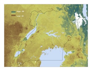
We introduce a newly created page on the ETRM blog: a repository of geo-spatial data for agricultural economists. After this blog post that summarized a list of publicly available datasets we learned about at the International Conference of Agricultural Economists in Milan, we realized that maintaining a more general list would provide useful service for agricultural and development economists who might benefit from access to and use of these data.

On our new page, we organize the datasets into three types: (i) precipitation and temperature, (ii) soil, and (iii) crop productivity and suitability. We provide basic details about each dataset, including spatial resolution, time scale, available variables, and sometimes information about how the data were created (e.g., interpolation, re-analysis, etc.). Many of these datasets can be overlaid with any other spatially referenced dataset and used to create covariates or instruments. See, for example, this incredibly fine-grained data from AfSIS on soil pH in Uganda!
We hope to continue adding to this list over time, so if you know of any useful geo-spatial dataset not currently listed, please send Leah (leb99@cornell.edu) or Julia (jb793@cornell.edu) an email.


Thanks for the posts. it helps in our learning